
The main objective of this measure is the retention and infiltration of rainwater. The good biological treatment and the retention of solute substances also allow the retention and pre-treatment of heavy polluted water. The light trough shape and the vegetation allow the integration into green areas.
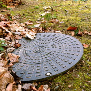
Wells filled with infiltration material and covered with soil, stones or other covering that absorb water from nearby paved surfaces
Headwaters are the source areas for rivers and streams, crucial for sustaining the structure, function, productivity and complexity of downstream ecosystems. In areas of high relief, afforestation of headwater catchments can contribute to slope stabilization and may reduce the risks associated with landslides.
Design of forest roads should be done in a way that surface water is diverted to the forest aside. Various surfaces cross drain solutions with a different level of maintenance need are available (e.g. rolling drain dip, culverts, rubber strips). They need to be combined with ditch dams for directing runoff. New forest roads should be planned carefully and only in exceptional cases. An interesting solution for small stream crossings can be the substitution of bridges or pipes by fords – e.g. after damages caused by flooding. This reduces the danger of blocking and flooding.
The measure includes the assessment of damages to the environment, mostly caused by accidents at sources of pollution e.g. containers with hazardous materials. Procedures and criteria’s need to be defined (beforehand).
The measure includes the assessment of damages at buildings and infrastructure (e.g. transport routes, water supply, and waste water disposal) concerning their usability and the necessity for restoration after an event. The measure is also important for the settlement of claims through insurance companies. In case that support from public disaster funds is available, procedures and criteria’s need to be defined (beforehand).
Zoning plans for undeveloped plots of land which have already been designated as development areas are adapted to account for the risk to these areas; if necessary, a new area is designated as planning area for the revision stage (while the municipality revises the zoning/development plan).
Exclude new developments that would increase the damage by shifting the location of the planned building outside the hazard area of the property.
Damage from pluvial floods can be reduced by taking pluvial floodwaters into consideration in development and zoning plans and by establishing free pathways for runoff. This can be done by building regulations, e.g. by designation of special grassland or protection zones in risk areas in the zoning plan. Such zones serve for retention and a controlled discharge of the water masses in case of heavy rain.

Pieces of land which have been zoned for development but are as yet undeveloped are declared to be unsuitable for building, or building permission is not granted.
Back flow or closing valves are connected to the piping system and close in case of back flow. Valves needs to be cleaned regularly.
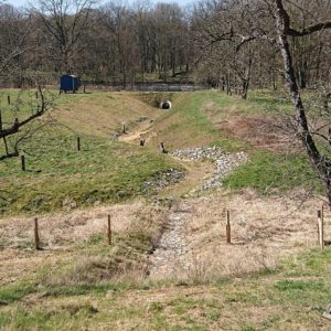
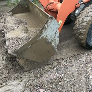
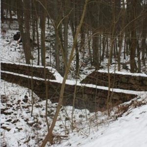
Check dams act as barriers to swift creeks and gullies or usually dry pathways of concentrated surface runoff. They can be constructed in form of a sill or a step. The measure reduces the longitudinal slopes, serves the accumulation of surface waters and controls the velocity of the concentrated surface runoff during intense rainfall events. It should be implemented in case of ineffectiveness of less intensive measures and requires usually permission.
Baulks are belts of uncultivated land separating fields from each other. If baulks are oriented in the direction of a contour, they can slowdown surface runoff and support infiltration. The highest efficiency is achieved when the measure is accompanied by an infiltration belt located above and a furrow located under the baulk. Implementation is recommended in case that other types of structural measures are ineffective or can’t be implemented.

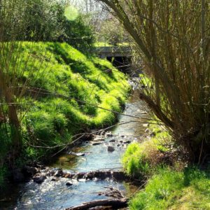
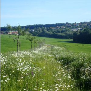
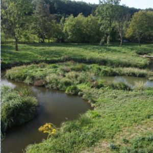
All kinds of blue and green infrastructure in the settlement areas (rivers, river valleys, water reservoirs, natural and artificial wetlands, parks, squares, orchards, gardens, allotments, green street strips, grasslands and other) decrease runoff and increase retention capacity. Preservation of the existing elements and creation of new elements is a contribution to heavy rain risk management and has a large number of additional benefits.
The measures describe vegetation-covered systems which are in varying degrees saturated with water. They pre-treat rainwater and extend the retention time. They can serve as buffer zones around water bodies. Pollutants are removed as a result of intensive sedimentation and assimilation by aquatic vegetation and adsorption in biogeochemical barriers e.g. in the form of gabions filled with dolomite or limestone and covered with a coconut mats. They are particularly important in the case of inflow of heavily polluted waters after heavy rain events.
Land use and land cover changes as well as intensification or extensification of land use are altering the hydrologic system and have potentially large impacts on flooding in lower lying areas. Upstream and downstream interconnections, interactions and action’s intereffects should be taken into consideration in planning activities, especially when problems occur in settlement areas. Formal as well as informal planning procedures aiming on integrated spatial development, rural development, climate change adaptation or other purposes are feasible for planning approaches covering entire catchment areas. Concept and plans should accommodate the likely changes in precipitation and flooding patterns derived from climate change. Inter-municipal cooperation is one possible approach. It allows e.g. better cooperation among fire brigades, improvement of retention and management of surface runoff etc.
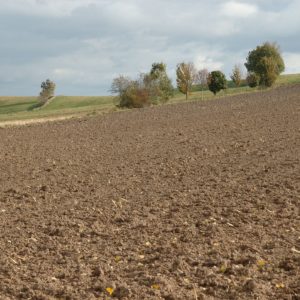
This measure helps to significantly reduce the risk of erosion on farmland. Due to the roughness of the surface structure, it helps the surface water to pass into the subsoil. In addition, surface water runoff is significantly decreased by a number of temporary storage spaces and a high level of turbulence. However, the measure is contradictory to other measures aiming on protective soil management and should be used with caution.

Risk communication activities in education can help to increase awareness and knowledge of risks in the future. The younger generations are particularly important for the future development of dealing with heavy rain risks. In addition, they are already exposed to the dangers today. Education on e.g. alternative methods of rainwater management raises awareness of younger people and help to establish sustainable practices.

Lease contracts are legally binding agreements between a lessor and a lessee of land. They contain terms and conditions to which the property has been leased out. The need for renewal of such agreements in case of a new lessee or expiring term of lease from time to time provides opportunities for the owner to implicate pluvial flood prevention measures by the insertion of restrictions (e.g. for a protective soil management or for a change of land use).

The measure aims at preventing disastrous consequences of heavy rainfall events as one of many different possible crisis situations. On all levels of administration there should be clarity about the responsibilities of state services, including mutual information and warning.
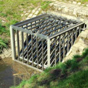
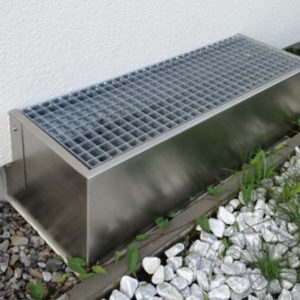
Sand and bedload traps are technical installations which are located instream or as bypass to water courses. In the event of flooding, they slow down the speed of the water and lead to controlled sedimentation of transported material. To prevent debris and timber from blocking water courses in forests and on agricultural land, wooden or metal rakes can also be installed in streams to retain carried material. Inlet rakes / trash racks are steel structures that prevent inlets to drainage systems from being clogged by debris. Such constructions are normally used near populated areas. All sediment and debris retention systems require constant inspection and maintenance.

Risk awareness grows and turns into action when recurring and continuous information and personal expert advice are provided to private home owners as well as to public bodies. Contact persons and public consultation hours offer a greater guarantee of success than online information services or advertising campaigns. Acceptance of measures can be additionally promoted if they are implemented in municipal buildings in a way that is effective for the public.
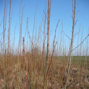
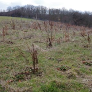
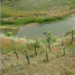
Heavy rain risk can significantly be reduced by converting farmland into grassland/deciduous forests or short rotation plantations. The measure increases the surface roughness constantly (effect: reduction of flow velocities) and decreases soil erosion (effect: reduction of mud deposition). The measure is well-suited for steep slopes with light soils, for runoff-pathways, for fields prone to flooding, and for drained areas near water courses.
Retention areas should be placed in the lowest points of urban areas. Surface drainage must ensure that water is diverted towards these areas – preferably on the surface (hollows, streets etc.). Receiving waters and soil needs to be protected from pollution. The realisation of central retention areas is greatly dependent on available space and the topographic condition. Development and zoning plans provide opportunities for implementation.
The main goal of this group of measures is to enhance the transformational and accumulation effects of existing and re-developing floodplains by terrain modifications like lowering of banks, offset or demolition of flood protection dikes etc. This allows the water to flood the floodplain during the periods of increased discharges.
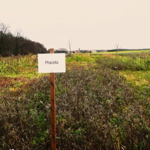
Crop rotation is adapted to suit the specific requirements of slopes. Intercropping is the practice of growing two or more crops in proximity. The use of cover crops prevents soil from being left without plant cover for extended periods of time. Among other benefits, such farming practices reduce erosion when it comes to surface runoff in case of heavy rainfall.

Trans-border risk assessment, communication of hydrological forecasts, the harmonisation of technical standards; cross-border cooperation on emergency planning and consideration of the cross-border impact of projects exist for the management of fluvial floods. Cooperation can be improved for the management of heavy rain risk.
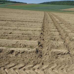
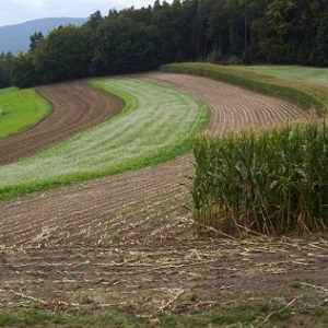
The development of runoff routes can be prevented and retention can be improved on slightly sloping terrain by cultivating farmland across the slope along contours. Ideally, the soil should be farmed in a chequerboard pattern to control and slow down the flow of surface water. In principle, the avoidance of downhill lanes, the creation of preferential runoff paths is prevented. In forested areas runoff concentration can be minimised by avoiding logging trails in slope direction.
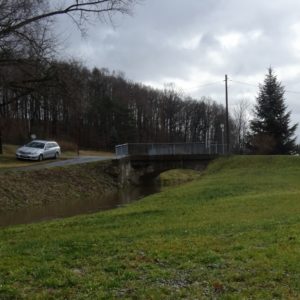
When flood occurs, safe drainage from the affected area is often dependent on the state of culverts and small bridges. These objects are often jammed by debris and thus cause local flooding. Often, the object itself is also damaged and as a result the traffic route is interrupted. Appropriate design in terms of capacity and clogging protection is very important. This measure represents a measure on small streams and ditches whose wrong design can have major impacts.

Small (unsealed) roads within forests and on farmland often cause surface runoff and erosion or they are damaged themselves in case of heavy rain. Furthermore, the road density can have a decisive influence on the water drainage of larger areas. Existing road network within forests and on farmland should be checked for its necessity and decommissioned if possible and necessary for reduction of pluvial flood risk. Desealing and improvement of infiltration can be aim of land consolidation processes.
Effective and periodically updated emergency response plans for the case of flooding caused by heavy rainfall help civil protection units to get a quick overview on measures to be taken and also on their priorisation. They are an important part of disaster control planning and need to be set up by responsible institutions (e.g. in Germany and Austria: municipalities; if necessary also companies). Emergency response plans need to be updated regularly to reflect changes of e.g. hazardous situations and risk exposure, changes in warning systems, in responsibilities, available resources (material, staff) and contact details.
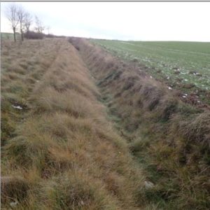
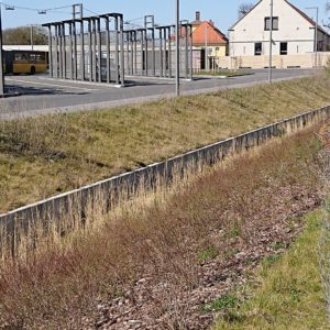
Ditches allow intercepting, infiltrating and alternatively draining the surface runoff without causing damage. They should be dimensioned to the corresponding return period of the discharge, meet functional requirements and get regular control and maintenance. Ditches on farmland are usually proposed in areas where the space for constructing furrows is limited. Within urban areas they are part of the urban drainage system and can have a variety of cross sections to suit the urban landscape. They can include the use of planting to provide enhanced visual appeal and water treatment. The measure requires an occupation of land. Therefore, settlement of property rights relations is necessary.
Predefined flow routes aiming on diverting surface water away from building can be built on the property or along its boundaries, e.g. by a change in gradient, ground sills, creation of depressions or by building of water diverting structural elements like walls. Areas on the property such as basins or trenches may be constructed for collecting the water and providing a controlled infiltration into the soil. Definition of requirements by municipality is possible.
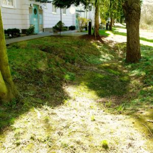
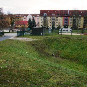
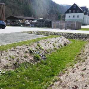
Natural or artificially created detention basins and depressions with a specific retention capacity can be used as temporary water reservoir for runoff water during heavy rainfall. They slow down the surface runoff; thus they contribute to a delay and attenuation of flood waves. They should be located at the deepest point in almost any surrounding – farmland, forests, along watercourses or within settlement areas on public or private ground. They fall dry during dry periods. Surface drainage water needs to be diverted towards them; regular maintenance needs to be assured (material accumulation).
Various types of retention basins through which a watercourse flows. There is always a barrier across the course of the watercourse, and during low water the watercourse runs unhindered through the bottom outlet. As soon as more water flows than the standard discharge of the bottom outlet allows, this increased discharge is held back and the basin gets flooded. Basins for flood retention can either be constructed dry or with a permanent storage area.
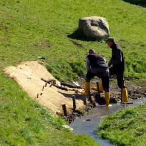
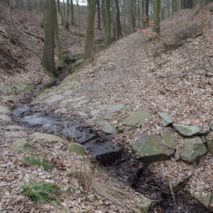
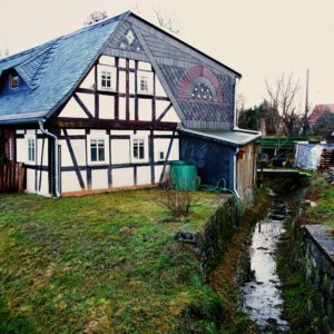
Embankments in the bump curves of the brook course can prevent overflowing, boulder structures prevent erosion of banks.
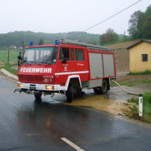
Preparation work is made, that in case of emergency all needed equipment and well-trained staff is available in a sufficient quantity.
Land-use planning is an effective instrument to reduce future heavy rain risk. The heavy rain risk can decrease significantly, if changes of use, adjustments of use, restrictions of use or heavy rain-adapted construction and development in flood prone areas are considered in both phases of planning: formulation and implementation of plans. The power of the instrument is very limited for existing built up areas in hazardous locations.
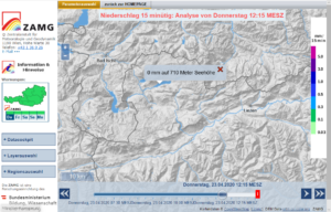
Continuous and long-term observation of natural phenomena increases the possibility of predicting them, estimating dangerous phenomena, and planning effective counteraction. Monitoring, forecasting and warning models and systems are usually established and operated by national institutions. They assure constant data collection, provision and quality control, as well as further development according to the state of the research. However, local or regional observation and monitoring may qualify such information or add additional information for decision making under time pressure in case of heavy rainfall events.
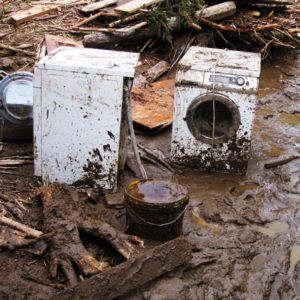
All pluvial flood events with damages should be documented and analysed regarding causes and impacts. The measure includes the assessment of buildings and infrastructure concerning their usability (e.g. transport routes, water supply, waste water disposal). Collected data are the basis for compensation requests to insurance or public disaster funds (if available). Moreover, lessons learnt can be drawn and measures be planned on the base of an analysis. This contributes to damage reductions at future events. Last but not least, collected data can be used in order to improve the quality of model calculations. Proper damage documentation requires a predefinition of criteria and standards.
Organisational precautions as well as emergency measures are taken immediately after an event in order to guarantee the functionality of structures that aim at the protection against pluvial flooding (e.g. removal of debris and mud).
Field subdivision aims to grow various, alternating arranged crops in a strip-type pattern, preferably in combination with cultivation across the slope. It is suitable esp. for crops with a tendency for erosion like corn or sugar beet that alternate with strips of e.g. gras or uncultivated fields. Crops prone to surface water runoff, erosion and ground cover are hence protected by crops with higher ground cover that reduce the risk of surface water runoff and erosion. Field subdivision should be combined with cross-management. Arrangements among farmers might be necessary.
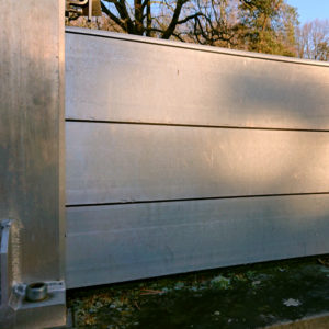
Flood barrier systems consist of rails (angle brackets, which are installed next to the front door, for example) and dam beams, which are inserted into these rails. In the time of need this can be done quickly. The bottom of the dam bar has to be sealed. The suitability of the measure might be limited for risk reduction in case of heavy rainfall as they happen unexpectedly and suddenly. Operational readiness requires precautionary behavioural measures, training for quick activation and regular maintenance of the system.
Specialized flood risk building consultants (engineer or architect) bring in their technical knowledge and experience. They assess the physical flood vulnerability and determine the effects of implemented flood risk mitigation measures. In some countries standardised procedures might be available according to which the experts proceed and issue flood certificates stating risk status advice for additional protective measures to house owners. The certificate might be required for insurance rating purposes.
Furrows are shallow and wide ditches on arable land with mild slopes and a small longitudinal gradient. They allow interception, infiltration and alternatively drainage of surface runoff. They should be dimensioned properly for meeting functional requirements and require maintenance.
Pluvial flooding should be considered in areas at risk. Damages in facilities can be reduced significantly, e.g. due to placement of electric installations, as well as damages originating from facilities, e.g. storage of dangerous goods and material. Periodical coordination with civil protection helps to avoid environmental damages. Plans should accommodate the likely changes in precipitation and flooding patterns derived from climate change.
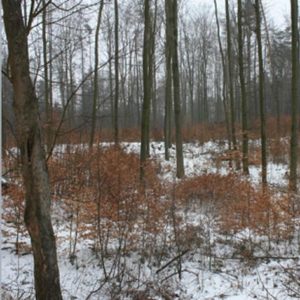
This measure resides in maintaining good forest health conditions through appropriate management (e.g. development of stable, stepped, unequal-aged forests, uniform shelter-wood systems and partial systems, coppice forests). The aim is to increase the soil infiltration, slowing surface runoff and reduce the risk of soil erosion by improving the forest health conditions. The management in forests should be focused on bringing them to natural state in order to increase their resilience and hence their ability to retain rainfall water and reduce the risk of flash floods in watersheds. Forestry should accommodate the likely changes in precipitation and flooding patterns derived from climate change.
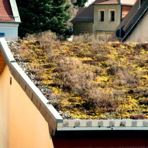
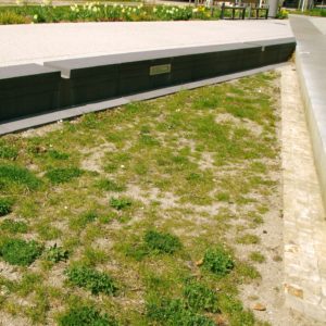
Through the vegetation of the soil substrate on the roofs water is retained and can evaporate. Two system of green roofing can be distinguished based on the level of maintenance: extensive green roof to an intensive green roof.

Relevant building openings can be protected against the entry of water by sandbags, boards or sandbag replacement systems, or secured additionally by lids and flaps. The measure requires some time to be operational – which is not available everywhere when heavy rainfall occurs. Additionally it requires training.
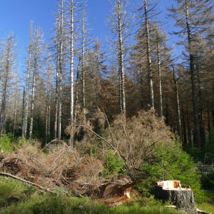
Larger open spaces, caused for example by timber harvesting and storms, are particularly critical areas for the development of floods. Avoiding large open areas – e.g. by promoting shelter before timber harvesting – and closing the resulting open areas as quickly as possible can noticeably reduce runoff from flood-sensitive catchment areas.
Flood early warning systems – if existing for the area – provide information that allow the actuation of emergency action (e.g. set up of a command unit, observation of risk areas) prior to the event and before damages occur. However, reduction of losses is possible only if early warning information are interpreted and assessed correctly, if they are underpinned with a risk assessment and action plans considering different scenarios. The collection and supplementing information from different (also from local) sources may facilitate and qualify the assessment of the information by the responsible personnel.
The measures reside in terrain modifications of channels and floodplain to increase their ability to slow down the runoff and to create inundation zones so that potential consequences of surface runoff would be reduced. They can include individual modifications that are generally termed “restoration”. Specifically, modification of the channel’s course, branching of streams, channel stabilisation, restoration of oxbows, accompanying riparian vegetation. The effect of the stream modification itself is not decisive in terms of surface runoff. However, if the modification is a part of a set of other measures in the contributing area, it can certainly play a positive role in slowing down the runoff and reduction of peak discharge. In general, the goal is to bring the stream as close as possible to the near-natural state.
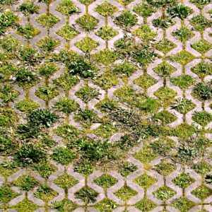
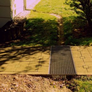
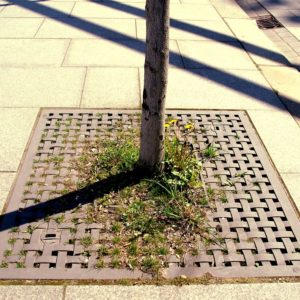
Permeable paving is designed to allow rainwater to infiltrate through the surface, either into underlying layers (soils and aquifers), or be stored below ground and released at a controlled rate to surface water. Sealed surfaces can be replaced by different materials, such as gravel turf, grass pavers, concrete pavers with drainage or porous concrete. This is suitable for parking lots, cycling paths, walking paths and access roads, terraces and yards.
Infiltration cells/trenches and gravel drains (with an overlying swale, as deep bed or tree planting pit) reduce runoff rates and volumes by retention/detention and therefore can help replenish groundwater and preserve base flow in rivers. They treat runoff by filtration through the substrate in the trench and subsequently through soil. They are effective at removing pollutants and sediment through physical filtration, adsorption onto the material in the trench, or biochemical reactions in the fill or soil. Near trenches pavements can be built, or places of recreation and sport activities.
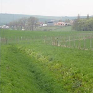
Infiltration belts should be projected on slopes in the direction of a contour. In the vicinity of reservoirs, watercourses and built-up areas they protect them against penetration with eroded material. Buffer strips offer good conditions for effective water infiltration and slowing of surface runoff. Hedges across long, steep slopes intercept and slow surface run-off water before it builds into damaging flow, particularly when there is a buffer strip alongside.
To increase the knowledge on heavy rain risk management different forms of interactive events and participation formats can be organized. The objectives and size can range from information (big or small events) to trainings and even individual consulting services. Participation formats for active involvement shall be included. An event or a participatory process could focus on, for example, the explanation of mapping activities and results, the identification of possible risk reduction measures and the explanation of best practice examples. In addition, events also serve networking and learning from each other. The integration of heavy rain risk specific contents into existing and well-known events or formats or the combination with other topics is possible.

All relevant actors in a community should be involved for developing an awareness of the risk and for starting cooperation. This can be done e.g. by establishment of a coordination circle (“round table”) with the participation of all actors from affected municipal departments, community council, citizens, emergency services, etc. An audit for recording the strengths and weaknesses of the existing precautions against all types of flooding can be an initiative. Creation of a municipal specification sheet “Flood prevention”, improved communication ways, networks or a master plan incl. priorisation of action can be the result of such a process.

Land consolidation is a planning process likely to clarify land ownership, reduce fragmentation of agricultural land ownership and to improve rural infrastructure and living conditions. This way it can reintroduce technical measures into collectivized field blocks, and positively influence landscape fragmentation for improving water retention and avoiding uncontrolled hazardous surface runoff. Land consolidation processes should accommodate the likely changes in precipitation and flooding patterns derived from climate change.

LEADER is an integrated development process in rural areas funded by EU CAP funds and designed to engage, enable, resource and empower local (rural) communities. The LEADER approach comprises e.g. bottom up elaboration and implementation of area based local development strategies; integrated and multi-sectoral actions; networking and cooperation. Heavy rain/flood risk reduction can be assigned as development strategy and implemented through related structural or non-structural actions. LEADER processes should accommodate the likely changes in precipitation and flooding patterns derived from climate change.
Relevant building openings can be protected against the entry of water by installing waterproof windows, shields and shutters, waterproof gates, or permanently installed self-rising floodgates.

Linear protection measures help to direct the water to areas, where it does not cause harm. Such measures are flood protection dams, flood protection walls, mobile flood protection systems, water drains (enhancement, removal of obstacles), storm water drainage and culverts, emergency waterways, flood channels, road drainage in case of new constructions and refurbishment. They have in common that they need maintenance, training in operating to ensure the functional capability.

Walls using in its construction vegetation fed with atmospheric precipitation. During rainfall, some rainwater is used to wet the surface of the plants and their life needs, while the part returned to the atmosphere in the form of evapotranspiration.

There is a large set of EU-requirements and standards that land managers have to meet in order to receive support scheme payments (“cross compliance”). However, local risk assessment may require exceeding mandatory standards. Here, voluntary agreements between farmer, land owner and municipality and local subsidies may help. Subsidies and agreements should accommodate the likely changes in precipitation and flooding patterns derived from climate change.
Public and private space such as streets or parking areas, play- and sportsgrounds can be designed for temporarily use as thoroughfare for runoff and/or temporary retention area and thus help to direct and/or slowdown runoff water in case of a heavy rain events. Temporary inundated areas or water squares are open areas in an urban environment which take up urban stormwater (e.g. from roof drainages). The incoming water is filtered first and, after temporal retention of up to 48h, is then delivered to streams or to the sewer system.
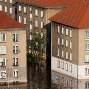
Insurance against natural hazards protects home owners against the financial consequences of floods caused by high water, heavy rainfall, backwater, earthquakes, subsidence, landslides, snow pressure, avalanches and volcanic eruptions. Most homes are not adequately insured against such natural hazards, although support from disaster funds is not expected. In Germany, for example, only 43 percent of all buildings are properly protected against the financial consequences of natural hazards.

No- or low (conservation) tillage totally or largely foregoes the use of ploughs. Instead, tillage tools are used that do not turn the soil (e.g. cultivators, disc harrows) or disturb the structure of the soil while leaving crop residues (= mulch) near or on the surface of the soil. Strip cultivation or striptill is a variable tillage and sowing method mainly for row crops, which creates a 15 to 20 cm wide seedbed, leaving two-thirds of the field untilled. The idea behind these technologies is to create a stable soil texture that is not highly susceptible to soil sealing while maintaining or increasing infiltration capacity. The measure is very efficient for heavy rain risk reduction on farmland by increasing of soil water retention and decreasing runoff.
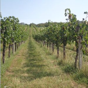
Permanent grassing or establishing of perennial vegetative cover of vineyards, hop gardens, and orchards reduces runoff and erosion. Vegetation controls erosion by protecting soil from displacement by raindrop impacts and by reducing the velocity and quantity of surface runoff. The measure should be accompanied by other linear biotechnological measures (e.g. ditches) and be implemented especially on slopes >7° and >4°on less permeable soils)
Requirements are expressed when granting building permissions, in order to prevent negative consequences of pluvial floods for buildings and for third parties.
If water cannot (or can only insufficiently) be prevented from entering the building, predefined flow routes in the building may help to minimise the damage. Ideally, provisions should be made for relief openings in the building to ensure that the water can flow away.
Potentially affected persons – esp. property owners – have to take personal provisions. However, establishment and maintenance of private protection structures is challenging and often not done on a regular basis. Authorities should promote and stipulate appropriate property protection measures at least by provision of information on web sites and written material.

Surface runoff at meadows and pastures is attenuated compared to land under arable crops. Thus, a high proportion of meadows and pastures increases the retention capacity of agricultural used land and reduces the surface runoff. Therefore, the preservation of existing meadows against cultivation of crops or building activities especially in head water areas, on slopes, in runoff pathways and along watercourses is a contribution to heavy rain risk reduction.

Because of their retention effect and because they protect slopes from erosion, forests reduce surface water runoff and sediment transport. Forest management should be adapted to suit the specific needs of vulnerable objects further down the slope. Large-scale logging operations, for example, need to be avoided. Forest composition should be managed to achieve a water retention level that is as high as possible. Forestry measures should accommodate the likely changes in precipitation and flooding patterns derived from climate change.

Easily understandable and accessible information is important to raise flood risk awareness and support the implementation of private risk reduction measures. It can be made available as reading materials, for example in print products (handbooks, guidelines, brochures, flyers) or on online platforms. The products should be tailored to a specific target group, e.g. citizens, homeowners, companies, forestry, agriculture, etc. A large number of high quality information materials have already been developed by various actors. The use of existing products should therefore be checked. Easy access to the information needs to be guaranteed, i.e. on a central platform or place. Additionally, public relation and media work support the distribution of information.
Rain gardens are small-scale vegetated gardens used for storage and infiltration. They are typically applied at a property level and close to buildings, for example to capture and infiltrate roof drainage. They use a range of components, typically incorporated into the garden landscape design as appropriate. Under the vegetation layer is a filter bed substrate located for absoption of infiltating water.
This group of measures includes linear and aerial permeable elements, furrows, rainwater reservoirs, vegetation roofs and vegetating for decentralised management of rain water aiming on better infiltration and evaporation in settlement areas. Applied in a complex, it can reduce not only the total volume of surface water but also the speed of surface runoff significantly. The measure has a large number of benefits for the environment.
The ground floor level of new buildings can be constructed in such a way that it is raised above expected flood levels. To achieve this, the following methods (among others) are available: 1. building on solid block foundations 2. raising the building on pillars 3. building on backfilled foundations What all designs have in common is that – as a rule – there is no cellar.
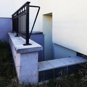
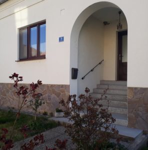
Relevant building openings are protected against the entry of water by constructing steps or flights of stairs with raised platforms and/or raised light wells. The edge of light wells at buildings should be placed 15 to 30 cm above the ground level dependent on the situation of the premises and risk. For basement entrances, additional roofing is recommended.
This measure is usually carried out in form of sets of barrages built in a direction perpendicular to a stream’s direction. The aim of the measure is to modify the erosion and accumulation processes in torrent streams through the retention of water and eroded material, e.g. when settlement areas are at risk. It effect is enhanced when applied together with other measures in the watershed. The material used for the barriers depends on the natural conditions of the area of interest and on hydro-technical calculations. Permission by water management authority and nature conservation authority may be required.
In case of a major danger, it might be useful to relocate existing buildings. Due to the avoidance and removal of the damage potential the resettlement and reallocation effects the risk reduction permanently. Financial support facilitates the implementation of the measure. Resettlement and reallocation measures need to be assessed and reviewed in advance. Social and personal burdens need to be taken into account.
Identifying and re-establishing of flood plains and deposition areas, such as by removal of protection structures for agricultural land, contributes to the retention of water along rivers and, thus, to heavy rain risk reduction. In the past, most floodplains have been taken over for other uses; former floodplain forests are separated from river and runoff pathways and modified into residual low-density forests without natural regeneration. Land use of flood plains can be different. Most space is required by self-regenerating floodplain forests (“mobile ecosystems”) – much more than floodplain grassland or reed beds. Restoration of such forests is a demanding and long-lasting process and requires planning; however, it is a crucial measure for climate change adaptation and mitigation.
Among other benefits, the measure serves as a heavy rain risk reduction measure as it delays and attenuates also water on its way to a stream. Wetland provides water retention and improves the hydrological regime of degraded land. Rewetting includes a wide variety of large and small-scale measures, e.g. impounding measures like blocking of drainage ditches or changes in the forest practice. Wetland restoration is a long-term measure, requiring a long-term-constant strategy and constant review.
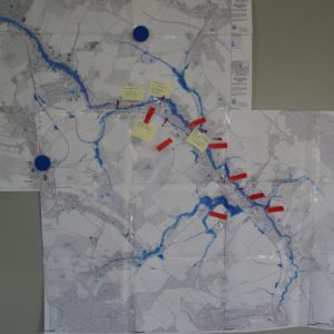
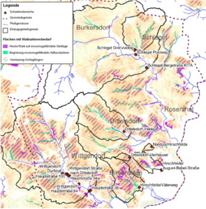
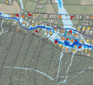
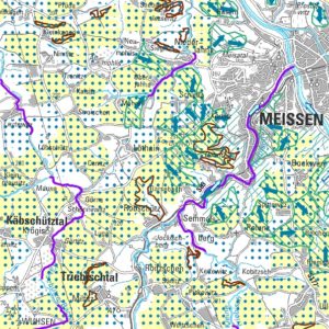
A proper hazard and risk assessment (with informative maps as central outputs) is the essential basis for starting an integrated risk management process. The assessment is a challenging multistep task, which requires – aside from clear objectives – input data (e.g. about historic events and damages, terrain and landuse data), methodological skills and decisions as well as resources. Based on the assessment results, the definition of an acceptable risk is necessary and the designation of land with a high risk of pluvial flooding for planning of appropriate risk mitigation measures is possible.

The measure resides in eliminating the risk of forest soil damage due to cutting. Specifically, the measure includes for example use of cable transport systems, caterpillar tractors, and avoidance of transport in the same routes. If damages of the forest soil occur, it is necessary to remediate them immediately in order not to disrupt the natural soil processes. Any remediation activities depend on the specific damages and should be conducted immediately after finalizing the cutting.
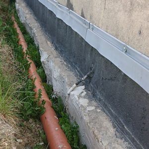
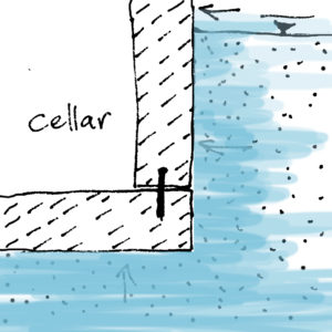
The measure is for waterproofing buildings against ground moisture and seepage water at below-ground structural elements like walls. There are horizontal or vertical sealing methods existing. Horizontal seals prevent that moisture rises up. Vertical seals prevent moisture to enter the building from the sides. There are several solutions available with bitumen (black tank) and with synthetic materials. It is important that vertical seals reach up to 30cm above ground with at least one horizontal seal.
Such systems consist of a variety of a hydrophyte treatment plants for eco-hydrological regulation. They are structured in three zones: a zone for intensive sedimentation (in which a combination of fixed and portable structures modifies the hydrodynamics of the chamber and increases sedimentation); another zone for intensive biogeochemical processes (where thick limestone fractions capture phosphorus compounds); and a third zone for biofiltration (for the removal of biogenic compounds using macrophytes). The zones are separated from each other by gabions from thick gravel, which additionally filter water.
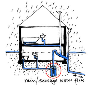
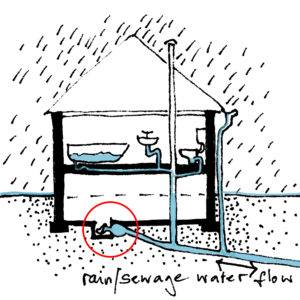
A sewage lifting unit basically consists of a collecting tank and a pump. The waste water flows to the collecting tank via a basic pipe and from there is lifted above the backwater level by the pump and transported further to the sewage system.

Furrow diking (also called tied ridging or furrow damming) is the formation of small earthen dikes across furrows e.g. for potato farming. A similar technique is soil pitting – the formation of small depressions at closely spaced intervals. Such techniques hold rainwater in place until it infiltrates the soil.
Such dikes aim to shorten the length of slope, thus slowing down surface runoff and reducing soil erosion on arable land. They also support the infiltration into the soil. They need to be can be constructed in the direction of contours with a zero longitudinal slope. Both, the area in front of the barrier and its height must be corresponding to the need for retention volume of water, including the volume of deposited eroded material. Most frequently, they are constructed in the form of an earth embankment reinforced by grass.
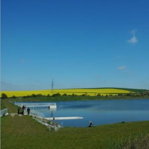
Reservoirs can be classified, among other criteria, according to size, however, the classification varies from country to country (e.g. CZ <2 000 000 m³ in parts smaller than 100 000 m³). For heavy rainfall risk management, small reservoirs on smaller water courses are of particular importance. They can protect objects in risk areas from the negative effects of floods after heavy rain and from the transported soil particles from erosion processes. The measure requires an occupation of (often agricultural) land. Therefore, settlement of property rights relations is necessary. Design documentation, planning permission, and realization might be demanding.
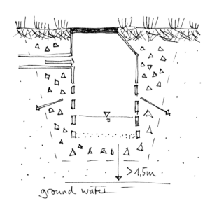
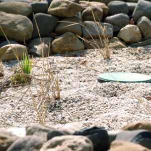
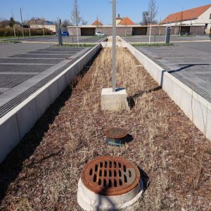
Soakaways are buried chambers that store surface water and allow it to soak into the ground. They are typically square or circular excavations either filled with rubble or lined with brickwork, pre-cast concrete or polyethylene rings/perforated storage structures surrounded by granular backfill. They can be built in many shapes and can often be accommodated within high-density urban developments, and can also be retro-fitted. (Source/copyright: NRWM-catalogue)
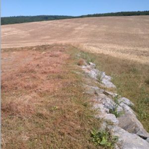
Pathways of concentrated surface runoff should be stabilised by permanent greening to prevent erosion. They can be reinforced by stones so that they are able to transfer the concentrated surface runoff without the occurrence of erosion on the pathway. The most common shape is a parabola with a low depth, which is most similar to that of the naturally created pathways. The measure requires an occupation of agricultural land. It should be implemented if protective soil measures are ineffective to protect soil from erosion. When accompanied by appropriate vegetation, they can be a part of the territorial system of ecological stability. The effect is enhanced when other measures exist in the contributing area. The consolidation of property rights relations might be necessary.

The measure covers all kinds of inormal planning documents for the improvement of land management in order to counteract dangerous phenomena of soil erosion and surface runoff in risk areas or minimise their effects (e.g. natural retention programs, urban adaptation plans for climate change, etc.). All regulations aim at determining directions of proceedings to reduce the occurrence of risk.
Traditional surface water drainage systems are often overloaded in case of heavy rain and thus cause flooding and damages. They can be developed further to “sustainable urban drainage systems” aiming on increasing their capacity e.g. when it comes to heavy rainfall and aligning them with natural water processes. There is a large collection of structural measures that belongs to this group measures. Some of them are listed in this catalogue. The system elements have in common that they require regular cleaning and maintenance.
Terracing is an ancient technology allowing the farming and building on steep and indented terrain. Farmland terraces consist of terrace platforms and terrace slopes or walls. In rural settings, the measure can reduce erosion and surface runoff by slowing rainwater to a non-erosive velocity. The measure is recommended for farmland with slopes >15°. However, terraces pose a significant impact. The can, therefore, violate the landscape’s ecological mechanisms. For this reason, they should be considered as an ultimate solution for the utilisation of land as farmland or building area and only if other land uses (e.g. afforestation) are impossible.
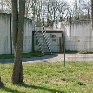
Underground tanks work as retention basins. They can be integrated in the planning process of urban infrastructure in the underground like underground car parks.
Visualisation of specific hazard and risk at site (e.g. on maps, installed billboard at locations etc.) is an effective way of pointing out dangers to affected persons and institutions. Maps indicate the specific hazard and risk on site and could be provided on the municipality’s online portal for example. Easily understandable information for the interpretation and a contact for questions are necessary.
By diverting the water away, adverse consequences in areas at risk are prevented in the event of floods up to design event levels. E.g. the property or parts of the property can be protected by a wall that surrounds the building and keeps running surface water away from it. However, before constructing a wall, investigations have to be carried out to determine whether the diversion of pluvial flood water does not infringe on the rights of third parties and if capacities for retention of water falling directly on the property are big enough. If necessary, additionally water retention measures have to be taken into consideration.
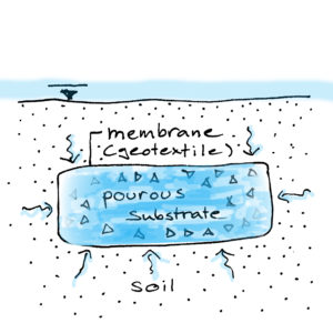
These solutions retain rainwater coming from infiltration. Everywhere where vegetation solutions are used for supporting retention, regardless of whether they are grass, trees, shrubs, plants used to create green roofs or green walls, the development of these plants can be supported by water absorbing geocomposite (GSW).
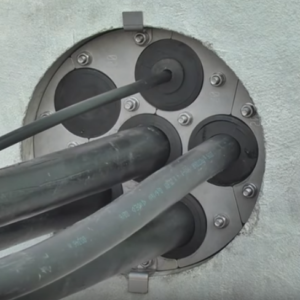
If water could enter the building through pipe passageways, heavy-rain-proofing requires waterproofing them.
Base plate and outer walls of new buildings can be constructed as closed tank by using concrete with high waterproofness. As no sealing is necessary such constructions are called “white” tanks. The measure is comparatively expensive.