

For local authorities, successful heavy rain risk management starts with assessment and mapping in order to identify, locate and evaluate potential heavy rain hazards and risks. Local authorities need to know where the water from heavy rain events accumulates and where it can pose hazards and risks to people, infrastructure and property on its way to the next river or lake. Mapping heavy rain hazards and risks helps to communicate the topic e.g. to citizens or emergency management services in the municipality.
This tool supports you in finding suitable methods for your municipality. Pick your starting point below.

Practitioners’ corner
This section is for municipalities who want a pragmatic approach to the topic. Here you can find basic information “which methods help me for which purpose”, “what do I need”, “whom shall I involve”, and “what needs to be done next”.

Experts’ corner
This section is for municipalities who are already familiar with the topic. Here you can find more detailed information on available approaches, experiences and scientific publications created in the context of the RAINMAN project.
- all
- urban area
- rural area with hilly landscape
- rural area in flatlands

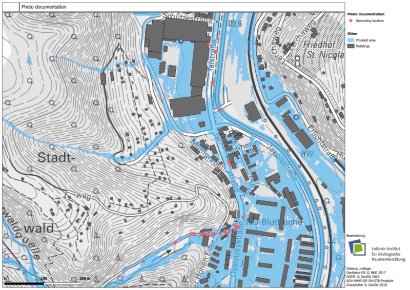
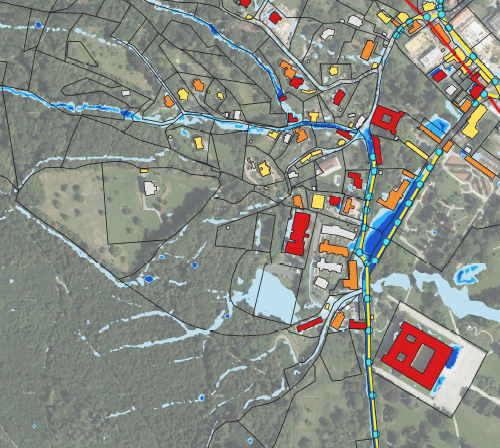
Heavy rain hazard map
(hydrodynamic simulations with HiPIMS) in Meissen, DE
Read more [pdf, 184 KB]

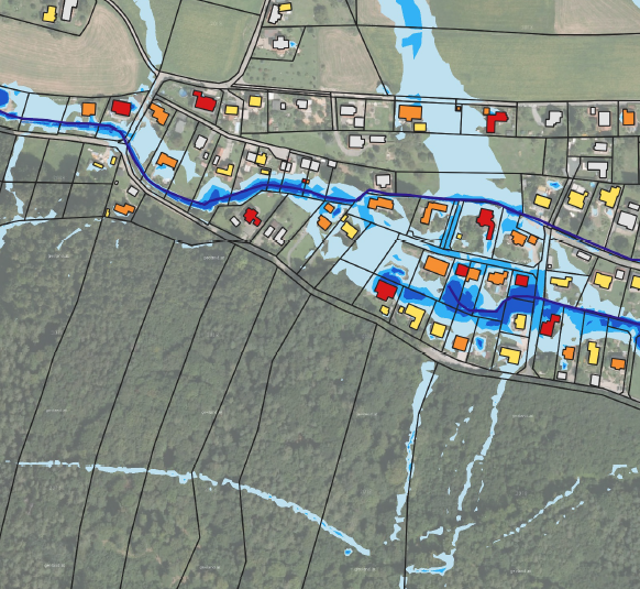
Heavy rain hazard map
(hydrodynamic simulations with Hystem-Extran 2d) in Meissen, DE
Read more [pdf; 625 KB]

Heavy rain hazard map
(hydrodynamic simulations with OpenLISEM) in Meissen, DE
Read more [pdf; 495 KB]

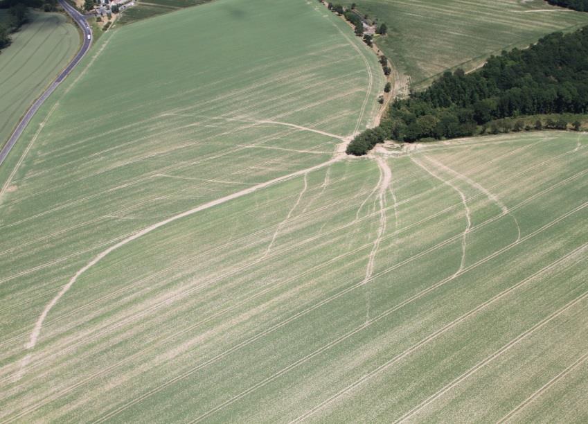
Heavy rain hazard map: Flow path analysis
in Meissen, DE
Read more [pdf; 402 KB]
Heavy rain hazard map based on event documentation
with FloodDocumenter for Meissen, DE
Read more [pdf; 683 KB]
Hydrological expert report
- Korbitzer Schanzen, Kirchsteigbachtal, DE
Read more [pdf; 332 KB]

Mapping of affected area and assessment of damages
– Kirchsteigbachtal and Triebischtal, DE
Read more [pdf; 376 KB]

Guideline for numerical simulations
for surface flow induced by heavy rain events, AT
Read more [pdf; 193 KB]
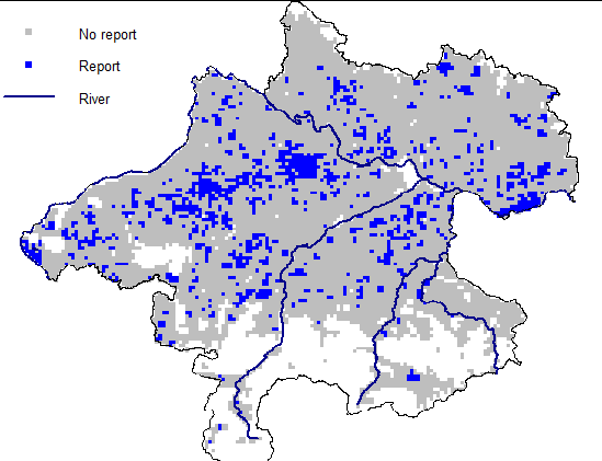
Statistical assessment of pluvial flood risk
for rural areas in Upper Austria, AT
Read more [pdf; 173 KB]

Integrated heavy rainfall risk maps
for the City of Graz – Catchment Annabach, AT
Read more [pdf; 260 KB]
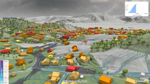
Integrated heavy rainfall risk maps
for the City of Graz – Catchment Stufenbach and Stiftingbach, AT
Read more [pdf; 362 KB]
Integrated heavy rainfall risk maps
for the City of Graz – Catchment Schloss Eggenberg, AT
Read more [pdf; 220 KB]
Integrated heavy rainfall risk maps
for the City of Graz – Catchment Katzelbach, AT
Read more [pdf; 223 KB]

Critical points analysis
for South Bohemia, CZ
Read more [pdf; 227 KB]
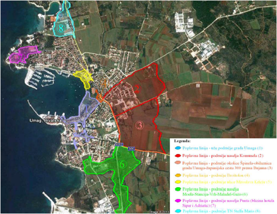
Heavy rain risk map
for Umag river estuary, HR
Read more [pdf; 678 KB]

Heavy rain risk map
for Zagreb, HR
Read more [pdf; 279 KB]

High-resolution excess water hazard and risk mapping
of agricultural areas in Tiszakécske, HU
Read more [pdf; 898 KB]

High-resolution excess water hazard and risk mapping
of agricultural areas in Kunhegyes, HU
Read more [pdf; 1.6 MB]
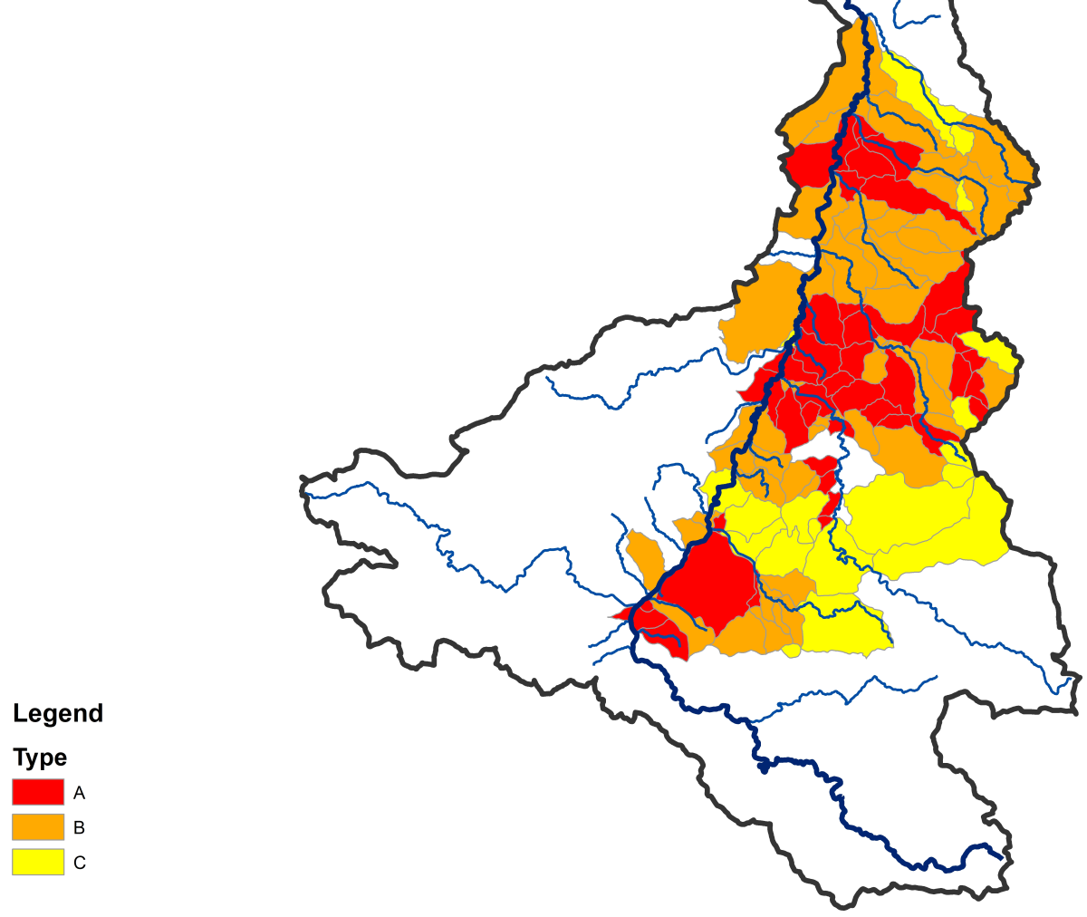
Flash flood hazard and vulnerability maps
for Lower Silesia, PL
Read more [pdf; 235 KB]
Mapping of areas vulnerable to soil water erosion
- Determination of problem areas in the Czerwona Woda catchment (Case Study)
Read more [pdf; 344 KB]
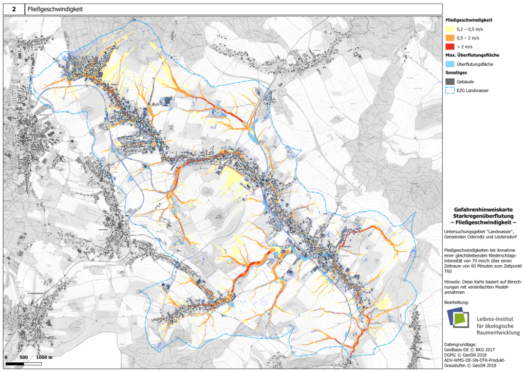
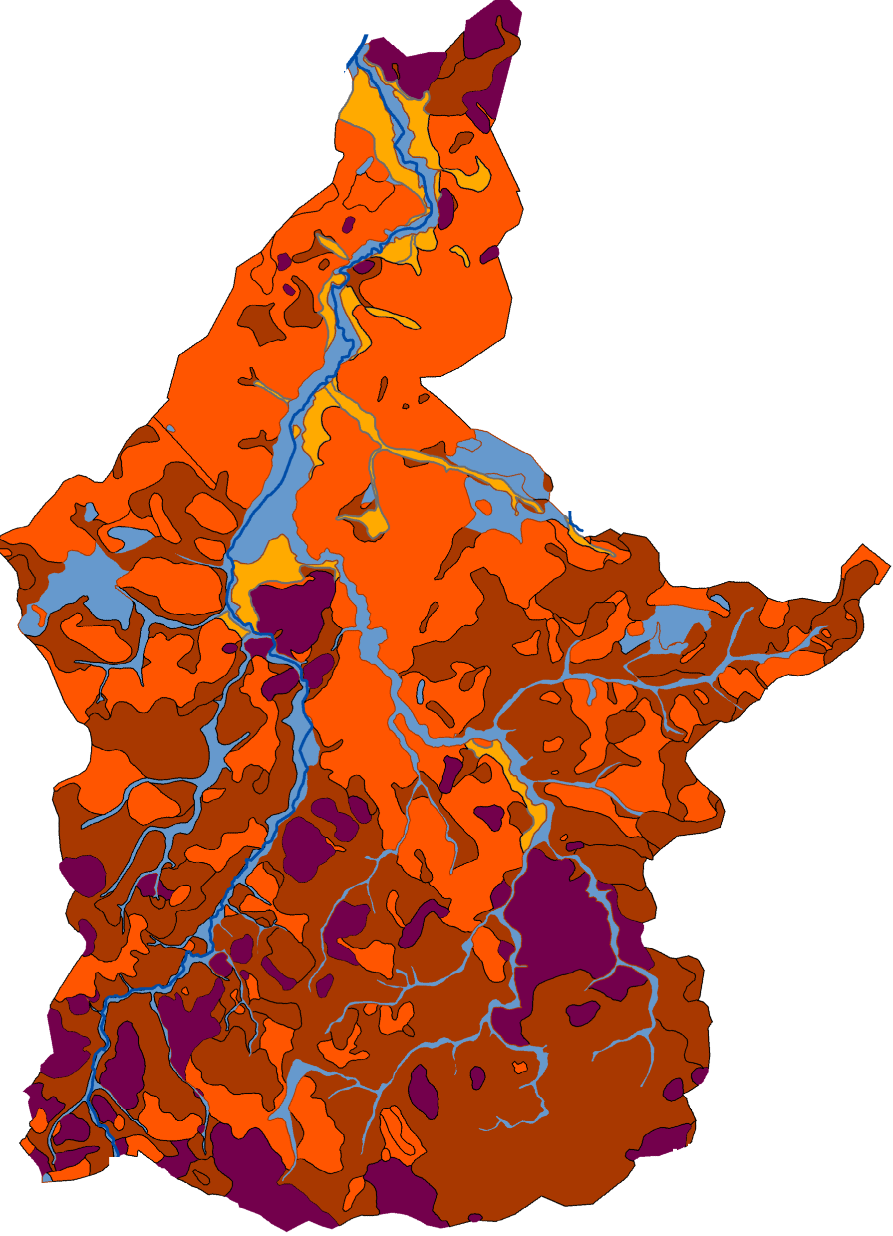
Heavy rain hazard map
(simplified hydrodynamic simulations with HiPIMS) for Landwasser catchment, DE
Read more [pdf; 324 KB]