

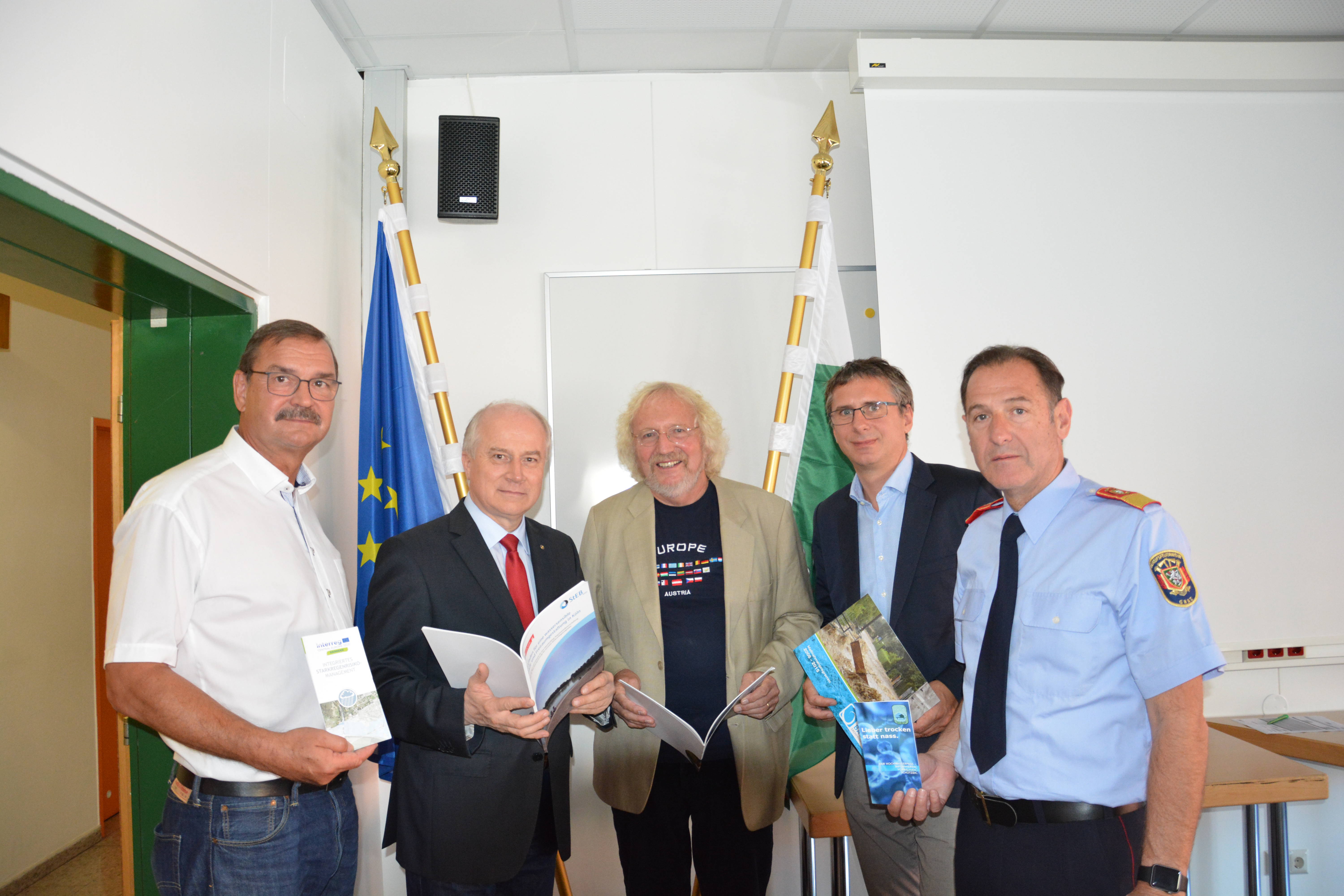
The Office of the Styrian Government, as project partner, and the City of Graz, as associated partner, continued their long-established close cooperation regarding flood risk management within the RAINMAN project. A joint analysis of the special challenges in heavy rain risk management in Graz laid the foundation for the development of RAINMAN activities. The focus was set on developing and testing risk management approaches regarding risk assessment and mapping, risk reduction measures and awareness raising. It was considered of special importance to involve institutions in charge in heavy rain risk management in the activities to ensure, that the results will be taken up for future actions.
- All
- Assessment and mapping
- Risk communication
- Risk reduction measures
Heavy Rain Risk Check
– “How well the City of Graz is prepared for pluvial flood events?”
Read more in English [pdf, 274 KB]
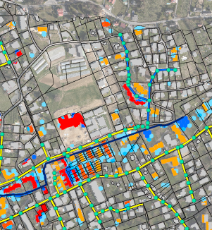
Integrated heavy rainfall risk maps for the City of Graz
- Catchment Annabach
Read more in English [pdf, 645 KB]
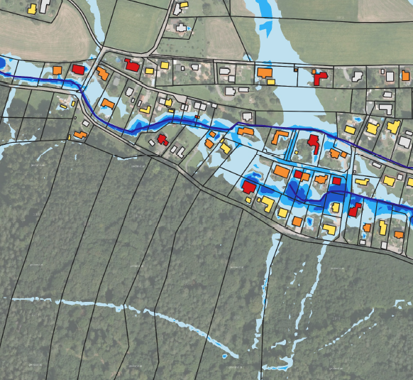
Integrated heavy rainfall risk maps for the City of Graz
– Catchment Katzelbach
Read more in English [pdf, 465 KB]
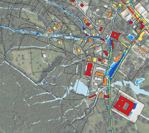
Integrated heavy rainfall risk maps for the City of Graz
– Catchment Schloss Eggenberg
Read more in English [pdf, 464 KB]
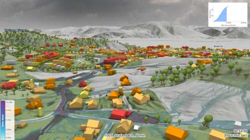
Integrated heavy rainfall risk maps for the City of Graz
– Catchment Stufenbach and Stiftingbach
Read more in English [pdf, 356 KB]
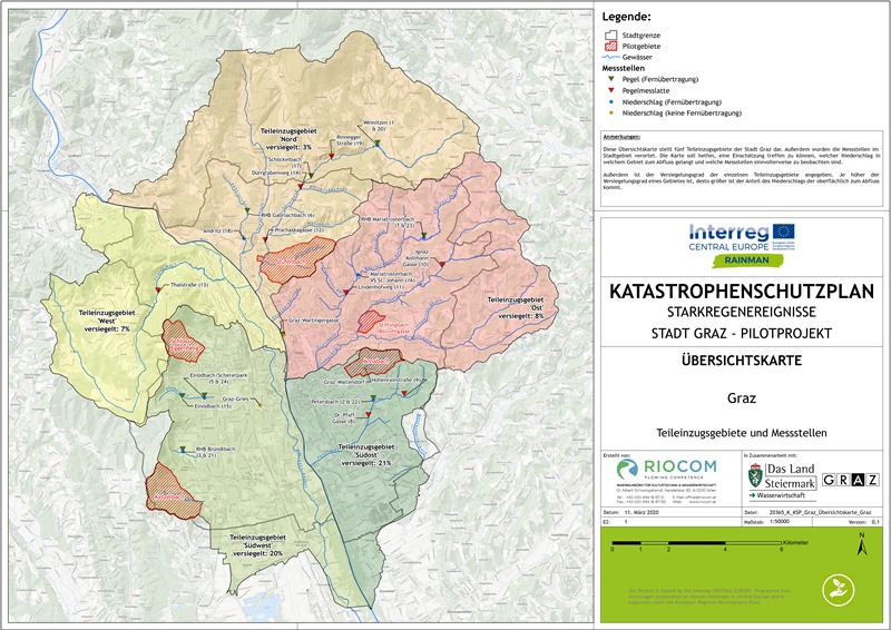
Experience in setting-up an emergency response plan
for selected study areas in the City of Graz
Read more in English [pdf, 225 KB]
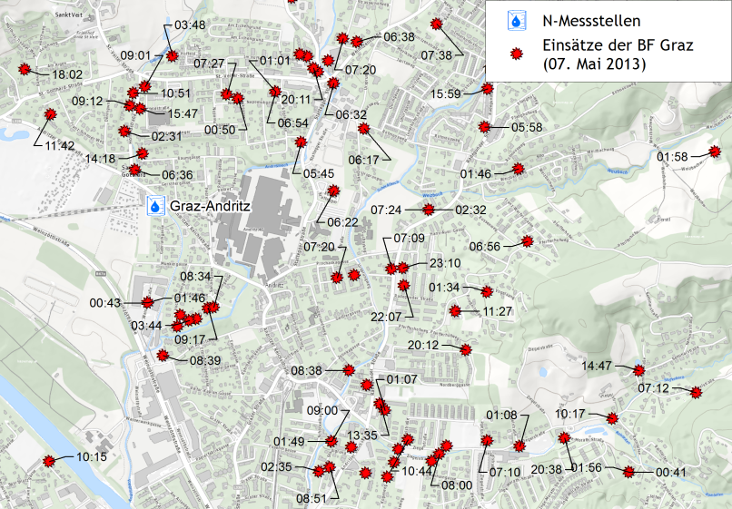
Recommendations for the improvement of the warning and alarm tool of the City of Graz
Read more in English [pdf; 644 KB]