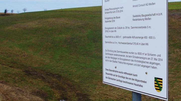
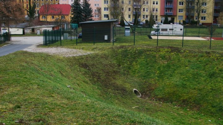
Creation of inundation zones

By

The main goal of this group of measures is to enhance the transformational and accumulation effects of existing and re-developing floodplains by terrain modifications like lowering of banks, offset or demolition of flood protection dikes etc. This allows the water to flood the floodplain during the periods of increased discharges.

Visualisation and explanation of the specific risk situation at site

By

Visualisation of specific hazard and risk at site (e.g. on maps, installed billboard at locations etc.) is an effective way of pointing out dangers to affected persons and institutions. Maps indicate the specific hazard and risk on site and could be provided on the municipality’s online portal for example. Easily understandable information for the interpretation…

Culverts – suitable hydraulic design

By

When flood occurs, safe drainage from the affected area is often dependent on the state of culverts and small bridges. These objects are often jammed by debris and thus cause local flooding. Often, the object itself is also damaged and as a result the traffic route is interrupted. Appropriate design in terms of capacity and…

Dry detention reservoirs and depressions of any capacity

By

Natural or artificially created detention basins and depressions with a specific retention capacity can be used as temporary water reservoir for runoff water during heavy rainfall. They slow down the surface runoff; thus they contribute to a delay and attenuation of flood waves. They should be located at the deepest point in almost any surrounding…

Dry retention reservoirs with a constant flow

By

Various types of retention basins through which a watercourse flows. There is always a barrier across the course of the watercourse, and during low water the watercourse runs unhindered through the bottom outlet. As soon as more water flows than the standard discharge of the bottom outlet allows, this increased discharge is held back and…

Establishing and considering of local and regional land-use planning

By

Land-use planning is an effective instrument to reduce future heavy rain risk. The heavy rain risk can decrease significantly, if changes of use, adjustments of use, restrictions of use or heavy rain-adapted construction and development in flood prone areas are considered in both phases of planning: formulation and implementation of plans. The power of the…