Tool risk reduction measures
IMPROVE EARLY WARNING
«The primary objective of an Early Warning System (EWS) is to empower individuals and communities […] to act in time and in an appropriate manner to reduce the possibility of […] loss of life, damage to property and the environment, and loss of livelihoods.»
UCAR 2010: 1-6
What do you find here?

Heavy rain early warning systems increase flood preparedness and lead to substantial reduction of damages in case of a heavy rain and flood event. Local authorities are recipients but also re-distributors of heavy rain / flood early warning information.
As municipality, here you get to know, how to improve your interpretation, assessment and dissemination capabilities for early warning information.
As private person, you find here useful advice on how to receive warnings and to act in time and in an appropriate manner.
You can also find an overview on existing early warning systems in Central Europe and browse our stories on implementation activities.
What is EARLY WARNING and how can it contribute to risk reduction?
Early warning information are standardised messages (signs, words, sound or images) that announce an imminent danger, e.g. from natural hazards. Heavy rain early warning information is dealing with the eponymous natural hazard “heavy rain”. Information is provided by higher authorities, regional or national institutions.
But early warning information itself does not keep hazards from turning into disasters. It needs entire EARLY WARNING SYSTEMS for enabling individuals at-risk, communities and organisations to prepare and act appropriately – in advance and during impending hazard events.
- Municipalities
- Private persons
Within an early warning system, the core role of the local administration or competent authority is to:
- Built-up sufficient response capabilities for the area,
- Strengthen the capacity of individuals’ at-risk and other local key actors to receive, analyse and act-on incoming warnings,
- Enhance/complement existing early warning systems by local data,
- Improve existing early warning systems by feedback to system developers.
In most countries of Central Europe, municipal personnel are a key actor for heavy rain early warning systems. They are the living link between incoming early warning information and local action (e.g. when mobilising emergency response). It is their task to know how to access and interpret warning information and how to organise dissemination and adequate action in advance.
Private persons are recipients and end users of early warning information. They need to:
- Be aware of the natural hazard heavy rain and know their individual risk which is dependent not only from the rainfall but also from local conditions and from their and their families' vulnerability.
- Rely on and use the early warning information provided by competent authorities.
- Built-up capacities to receive, to analyse and to act-on early warning information.
How can I access early-warning information?
In Central Europe, early warning information are available from different sources. Institutions on different levels – from continental down to regional or community level – run early warning systems. Most early warning systems are accessible online via webpages or special applications for mobile devices. Early warning systems might be accessible also for citizens and private persons, but not all operators provide public access to warnings.
- Municipalities
- Private persons
Make sure that you benefit from existing functional early warning systems. Find open access options below in our country-specific early warning systems overview.
Dependent on local risk and on available early warning information it might be helpful to additionally invest in local monitoring and observation. However, local monitoring alone cannot replace early warning information provided by competent authorities. It only provides supplementary information.
Prepare in advance: by installing apps designed for collecting official warning notifications and weather alerts or by signing up to mass notification systems you can turn your smartphone into an early warning system with individual setting for crisis type, area and so on. Some of these applications also provide recommendations for action or allow exchange and coordination with others. Find some options for Germany, Austria and the Czech Republic below in the early warning app overview.
Furthermore, it is beneficial to bookmark useful web pages for weather forecasts, flood warnings, local river levels. Find open access options below in the country-specific early warning systems overview.
How should I interpret early warning information?
Dealing with heavy rain means dealing with uncertainties. This is because of heavy rainfall events are very difficult to predict, the forecast lead time is very limited, and there is a high chance of forecast errors in spatial occurrence and/or timing of the event. Nevertheless, they are beneficial as they give an indication – also for appropriate emergency response measures.
- Municipalities
- Private persons
Responsible persons in municipalities need to understand the early warning information they receive, in order to effectively interpret them and set the appropriate measures. Early warning experts could offer exchange with or training of municipality key persons if needed; good municipality substitute planning helps to have a competent early warning person on duty at all times. Qualification sources are e.g.:
- Information as well as trainings provided by operators of early warning systems on interpretation and assessment of early warning information;
- Information provided by more independent sources, like tutorials or free online trainings, e.g. from the EFAS (European Flood Awareness System) consortia.
When disseminating early warning information further to recipients, communicate the uncertainty level in a standardised and understandable manner.
Make sure that you know what to do when you receive a warning!
Make yourself familiar with information provided by web pages and apps. Predictability is limited. This is explained somewhere and is to be considered. Furthermore, warnings are often connected to guidance for action.
You can also contact your municipality to learn more about local emergency alerts, to get information material or to book even a seminar on how to better prepare for flood events and other natural disasters.
How can I prepare dissemination of early warning information to the key stakeholders and ensure adequate action?
The translation of early warning information into adequate action requires skills, experiences and also a feeling for strengths and weaknesses of the early warning system that you rely on.
- Municipalities
- Private persons
Take the following precautionary measures in non-event phases:
- Make sure that responsibilities are clear. Who interprets warnings, disseminates them to further recipients and triggers the alarm if necessary? A confirmation of receipt might be required.
- Clarify the legal framework before starting disseminating early warning information to recipients.
- Establish multiple communication channels and ensure consistency of warning language among them.
- Ensure your warnings are clear and easy to understand.
- Educate recipients/community on how warnings will be disseminated, how to interpret them and how recipients need to respond to warnings. Communicate priorities and boundaries of emergency operations in your area clearly.
- Carry out system wide tests and organise exercises within the community at least once each year.
In non-event phases, work out and disseminate further recommendations for action to citizens. Make sure that they focus on private property protection and on flood protective behaviour of the public. With respect to heavy rain, always stress two key facts:
- Heavy rainfall can happen everywhere and is expected to increase in frequency and intensity.
- The predictability of convective heavy rain events is very limited and forecasts are uncertain.
- Do not wait until it rains to start preparations; you won’t have time then!
- Find out if you’re at risk.
- Sign up for warnings.
- Know how to turn off gas, electricity and water in your home.
- Ask your municipality about flood protection advice and design your personal emergency plan.
- Get permits before you build; PREVENT DAMAGES at your house and property by appropriate private protection measures.
- Protect your property by advance measures: Visit our CATALOGUE OF 100 RISK REDUCTION MEASURES for further information.
- Always report blocked ditches, swales and channels to your municipality.
- Check your insurance: Make sure you have an insurance to protect your home or business. If you have a buildings and contents insurance, check if flood damage is included. A natural hazard insurance against damage caused by heavy rain covers all contents of the flat or house.
- Connect to local flood groups on social media and contact your community for volunteering options: Your area may have community flood wardens. These are volunteers who e.g. monitor a specific local area and inform its residents when flooding is likely or you can volunteer in a fire or water brigade.
Early warning systems overview
Early warning systems are based on robust and reliable communication infrastructure hardware, operate 24 hours a day and use multiple communication channels. Some early warning systems consider multi-hazard-scenarios. Heavy rain and pluvial flood early warning systems deal either with meteorological or with hydrological data or with a combination of both types. Find here systems from different Central European providers:
Meteorological severe weather warning systems:
…are based on meteorological data, provide the most relevant information needed to prepare for extreme weather.
| Name | Meteoalarm |
URL |
|
Type | Meteorological severe weather warning systems |
Operator and spatial scope | EUMETNET, the Network of European Meteorological Services, Europe |
How does it work? (input data, method) | The website integrates all important severe weather information originating from the official National Public Weather Services in Europe. All warnings for heavy rainfall with risk of flooding, severe thunderstorms, gale-force winds, heat waves, forest fires, fog, snow or extreme cold with snowstorms, avalanches or severe coastal tides are available. |
Where to get information and how to interpret them? (communication products/channels, guidance how to interpret the information/graphics etc.) | In one glance you will be able to see on an overview map where in Europe the weather might become dangerous. The colours used on the maps on the website indicate the severity of the danger and its possible impact in four warning levels (green, yellow, orange, red). On the European map each participating country is coloured consistent with the highest colour assigned to a current warning. Clicking on a country will link you to national and regional warnings. Additionally a RSS feed gives the opportunity to subscribe and to customize the information stream. |
Lead Time | 2 days |
Update Cycle | 20 minutes |
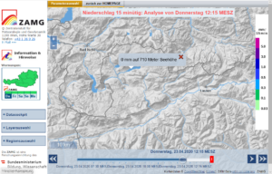
Name | INCA |
URL |
|
Type | Analysis, Nowcasting, Forecast |
Operator and spatial scope | The Central Institution for Meteorology and Geodynamics (Zentralanstalt für Meteorologie und Geodynamik), Austria |
How does it work? (input data, method) | For the INCA nowcasting three main data sources are taken into account and are statistically combined in an optimal way:
|
Where to get information and how to interpret them? (communication products/channels, guidance how to interpret the information/graphics etc.) | INCA is available as map viewer for precipitation, thunderstorms, temperature, wind, cloud cover and snow. Free version for the public Free version for emergency service organizations Commercial version |
Lead Time | 6 hours (nowcasting limit) |
Update Cycle | 5-60 minutes, depending on the parameter |
Name | RAPID INCA |
URL | Customer-specific URL |
Type | Analysis, Nowcasting, Forecast |
Operator and spatial scope | The Central Institution for Meteorology and Geodynamics (Zentralanstalt für Meteorologie und Geodynamik), Austria |
How does it work? (input data, method) | The RAPID INCA system is a method to predict heavy rain events in small catchments. For the temporally and spatially high-resolution precipitation forecasts, current measurement data of weather stations and the weather radar is used. With the help of RAPID INCA, the current distribution of precipitation is redetermined every 5 minutes. Based on the current distribution of precipitation, the potential tracks of storm cells are calculated and a forecast for 1 hour is created. The spatial resolution is 1 km. For selected areas / smaller areas, also a threshold-based heavy rain warning is offered. If the forecast precipitation in the area reaches the warning threshold, the user receives a warning and information via SMS / email. |
Where to get information and how to interpret them? (communication products/channels, guidance how to interpret the information/graphics etc.) | Free version for emergency service organizations Comercial version |
Lead Time | 1 hour |
Update Cycle | 5 minutes |
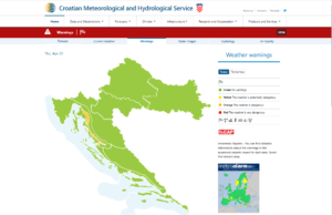
Name | DHMZ weather warnings (DHMZ upozorenja) |
URL |
|
Type | Meteorological severe weather warning system |
Operator and spatial scope | DHMZ – Croatian Meteorological and Hydrological Service (Državni hidrometeorološki zavod), Republic of Croatia |
How does it work? (input data, method) | Aire Limitée Adaptation dynamique Développement InterNational – ALADIN (3 days, 3h freq., 8 km); limited area numerical weather prediction (NWP) model European Centre for Medium-Range Weather Forecasts – ECMWF IFS (10 days, 3-6h freq., 25 km); global NWP model Croatian Waters receives data from the DHMZ about the forecasted precipitation through the ALADINHR4 model. It covers forecasted precipitation (rain, snow, total), temperature, humidity, wind and cloud cover in a 4×4 km grid, and is available for 72 hours in advance. The file format is ASCII. In addition to that, data from the global ECMWF model is also received through DHMZ (the same parameters). |
Where to get information and how to interpret them? (communication products/channels, guidance how to interpret the information/graphics etc.) | Open Licence: Warnings are presented on a map and with symbols, see: https://meteo.hr/naslovnica-upozorenja.php?tab=upozorenja Awareness reports are available for 14 areas. |
Lead Time | 72 hours |
Update Cycle | 1 h/day, depending on the type of presentation |
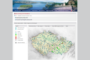
Name | Flood forecasting and warning service (Hlásná a předpovědní povodňová služba) |
URL |
http://portal.chmi.cz/files/portal/docs/meteo/om/vystrahy/index.html |
Type | Integrated Warning Service System |
Operator and spatial scope | Czech Hydrometeorological Institute (Český hydrometeorologický ústav), Czech Republic |
How does it work? (input data, method) | CHMI‘s warning service is a component of Integrated Rescue System of the Czech Republic supplying warnings for the territory of the Czech Republic for both meteorological and hydrological risks. For information on discharges and flood forecasting, the CHMI uses:
Gauge-based flood predictions are based on both measured and predicted precipitation sums by using the so-called unit-hydrograph approach. This method focusses on a functional relationship between precipitation and runoff based on historical events and is valid for small catchments. These predictions are then classified with respect to discharge statistics (e.g. discharge with 1-year return period HQ1) to take the uncertainties into account. |
Where to get information and how to interpret them? (communication products/channels, guidance how to interpret the information/graphics etc.) | Warning information is presented at a special CHMI web page. Concerning the floods, there is a special web page of the CHMI providing not only the warning, but also other related information. Flood forecasting service page contains the summary of descriptive and actual information from gauging stations, hydrological forecast from forecast stations and other meteorological and hydrological information. Flash flood guidance (Indikátor přívalových povodní) is an integral part of the flood forecasting and warning service. It presents the estimation of current soil saturation through a procedure which takes into account the previous rainfall, runoff and evapotranspiration. The output indicates areas potentially endangered by rain events with certain heights. The tool is available online. |
Lead Time | – |
Update Cycle | Hydrological data – 10 min, hydrological forecast – daily or more often as needed, precipitation – 10 min. |
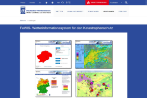
Name | FeWIS – Weather information system for civil protection (Wetterinformationssystem für den Katastrophenschutz) |
URL |
|
Type | Meteorological severe weather warning system, nowcasting product |
Operator and spatial scope | German Weather Service (Deutscher Wetterdienst), Germany |
How does it work? (input data, method) | Among others, FeWIS provides information on convective cells (thunderstorms) via a system called KONRAD. KONRAD represents DWD’s scheme for automated detection, tracking and forecast of thunderstorms based on weather radar data. It provides comprehensive and reliable information about their intensity, direction of movement, and issues hail, heavy rain, and wind gust warnings. |
Where to get information and how to interpret them? (communication products/channels, guidance how to interpret the information/graphics etc.) | FeWIS is an information platform with limited access mainly for civil protection units (e.g. fire brigades). Through FeWIS, users are provided with current weather information, weather warnings and current radar derived precipitation data as well as short time radar-based forecasts (via the storm cell identification and tracking method KONRAD). Furthermore, FeWIS informs also about the current wild fire risk and about pollutant dispersion in the air in case of an accident. |
Lead Time | 2 hours (radar nowcast) |
Update Cycle | 5 minutes |
| Name | Public weather warning system of the Hungarian Meteorological Service (OMSZ időjárás veszélyjelző rendszer)
|
| URL | 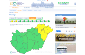 https://www.met.hu
 |
| Type | Weather forecast and warning system against meteorological hazards and weather extremes
|
| Operator and spatial scope | OMSZ – Hungarian National Meteorological Service (Országos Meteorológiai Szolgálat), Hungary
|
| How does it work? (input data, method) | [Source of the following text: Hungarian Meteorological Service (2019): “Public weather warning system of the Hungarian Meteorological Service” (pdf, 186 KB)]
Outlooks and warnings are issued for following weather phenomena: thunderstorm, torrential rain, wind gust, freezing rain, blowing snow. Very short-range warnings (alerts) on these phenomena are not issued!
In general, the area, on which outlooks and warnings are issued, varies in size but the smallest area, for which the forecasts apply, is usually equivalent to half of an average county in Hungary.
|
| Where to get information and how to interpret them? (communication products/channels, guidance how to interpret the information/graphics etc.) | The severe weather information is provided in two steps.
|
| Lead Time | Warnings are usually issued with lead-time of 0.5-3 hours.
|
| Update Cycle | Dependent on the weather situation, the warning, once issued, can remain valid for 3 to 6, or even up to 12 hours. In most of the cases, after such time, the warnings are either updated or cancelled. Because warning is a forecast product, it can be modified, updated anytime, upon most recent data and information. |
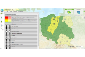
Name | ISOK – The IT system of the Country’s Protection Against Extreme Hazards (Informatyczny System Osłony Kraju przed nadzwyczajnymi zagrożeniami: ISOK) |
URL |
|
Type | Warning system against meteorological hazards and weather extremes |
Operator and spatial scope | A consortium of Polish institutions, including the Institute of Meteorology and Water Management – National Research Institute (IMGW-PIB) |
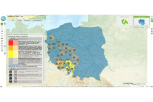
How does it work? (input data, method) | ISOK is a comprehensive, advanced tool for analysing and warning against dangerous meteorological and hydrological phenomena. The Map Portal of ISOK is one of the main components of the system that publishes a range of information on hazards caused by meteorological and hydrological conditions. The Map Portal includes among others: Warnings issued by IMGW-PIB, Maps of Meteorological Hazards, Flood Risk Maps, Flood Hazard Maps. The Meteorological Hazard Maps provide two type of maps: (i) climatological maps – spatial variability of the occurrence of extreme weather phenomena that have occurred in recent decades and (ii) operational/prognostic maps – present the areas where these phenomena are currently forecasted. The operational (prognostic) hazard maps provide early information to the public about the possibility of occurrence a dangerous meteorological phenomenon. The Operational Meteorological Hazard maps are generated automatically in the system and provide forecasts for the nearest 12, 24, and 48 h with spatial resolution of the model of about 7.7 km (currently). Warnings issued by IMGW-PIB provide important severe weather information, according to the criteria for different alert levels (moderate, high, very high). Meteorological warning is a special type of weather forecast focused only on a phenomenon, its intensity and impact that causes dangerous situation. Issuing a warning means that the probability of the phenomenon occurring is very high and its intensity will threaten the safety or life of the people and causes property damages. The issue of a meteorological warning is crucial information for crisis management services. When they receive such a meteorological warning, they take additional measures to protect health and human life and property. |
Where to get information and how to interpret them? (communication products/channels, guidance how to interpret the information/graphics etc.) | ISOK is an important element supporting crisis management in Poland and information platform for institutions responsible for protection of flood risk areas. Warnings and Meteorological Hazards Maps are available for everyone without the need to log in. A user who registers in the Mobile Application of the ISOK system receives warnings about hazards and other dangers related to natural phenomena. A registered user receives warnings as text messages (SMS) or e-mails only for a specific interest area chosen by the user. |
Lead Time | Next 12, 24, and 48 hours (Operational Meteorological Hazard Maps). Warnings e.g. against storm/thunderstorm are usually issued with lead-time of 2-3 hours. |
Update Cycle | 12 hours (Operational Meteorological Hazard Maps). The warning, dependent on the weather situation, are modified and updated anytime if the most updated data and information are available. |
Flood warning systems:
…combine hydrological and predicted rainfall data.
Name | EFAS – European Flood Awareness System |
URL |
|
Type | Hydrological Early Warning System |
Operator and spatial scope | Copernicus Emergency Management Service, Europe |
How does it work? (input data, method) | EFAS provides a lot of flood related information. Among others, flash flood related information is provided by ERIC flash flood indicator. The ERIC flash-flood indicator is generated by comparing the forecasted surface runoff accumulated over the upstream catchment with a reference threshold. It is based on the 20-member COSMO-LEPS ensemble for precipitation and soil moisture forecasts from the LISFLOOD hydrological model and provides indicators for the next 5 days for catchments smaller than 2,000km2. |
Where to get information and how to interpret them? (communication products/channels, guidance how to interpret the information/graphics etc.) | Information is accessible through a Map Viewer. Two ERIC products exist:
|
Lead Time | 5 days |
Update Cycle | 12 hours |
Name | Water level news and flood predictions (Wasserstandsnachrichten und Hochwasserprognosen) |
URL |
https://www.noe.gv.at/wasserstand/#/de/Messstellen/Map/DurchflussPrognose |
Type | Hydrological Early Warning System |
Operator and spatial scope | Hydrological Service of Lower Austria (Hydrographischer Dienst Niederösterreich), Lower Austria |
How does it work? (input data, method) | Gauge based flood predictions are based on measured and predicted precipitation sums by using the so-called unit-hydrograph approach. This method focusses on a functional relationship between precipitation and runoff based on historical events and is valid for small catchments. These predictions are then classified with respect to discharge statistics (e.g. discharge with 1-year return period HQ1) to take the uncertainties into account. |
Where to get information and how to interpret them? (communication products/channels, guidance how to interpret the information/graphics etc.) | The forecasts are presented on the website as information, as there are no warnings issued for small catchments (because of large uncertainties mainly due to the precipitation forecasts and therefore a high probability of false alarms). |
Lead Time | 12 hours |
Update Cycle | 1 hour |
| Name | Croatian Meteorological and Hydrological Service (DHMZ) |
| URL |
|
| Type | Meteorological severe weather warning system |
| Operator and spatial scope | DHMZ – Croatian Meteorological and Hydrological Service (Državni hidrometeorološki zavod), for the territory of the Republic of Croatia |
How does it work? (input data, method) | Aire Limitée Adaptation Dynamique Développement InterNational – ALADIN (3 days, 3h freq., 8 km and 4 km); limited area numerical weather prediction (NWP) model European Centre for Medium-Range Weather Forecasts – ECMWF IFS (10 days, 3-6h freq., 25 km); global NWP model Croatian Meteorological and Hydrological Service (DHMZ) disseminates forecasts to Main (National) Flood Protection Centre and other interested parties as well as to general public through multiple channels such as WEB, FTP, TV forecasts etc. The main (National) Flood Protection Centre compiles information received, with other relevant information such as daily and hourly recorded water levels, water flows, precipitation, temperatures, hydrological forecasts etc in daily report which is delivered to parties and persons involved in operative flood defence in Croatia, and if needed to flood protection administrations of neighbouring countries and general public. |
Where to get information and how to interpret them? (communication products/channels, guidance how to interpret the information/graphics etc.) | Warnings are presented on a map and with symbols, see: https://meteo.hr/index.php Forecasts for the next 3 / 7 days: https://meteo.hr/prognoze.php?section=prognoze_model¶m=3d Definitions of all symbols: https://meteo.hr/prognoze.php?section=prognoze_model¶m=meteoroloski_simboli |
| Lead Time | ALADIN: 72 hours ECMWF: 10 days |
| Update Cycle | 1 h / 1 day, depending on the type of presentation |
Name | Flood forecasting and warning service (Hlásná a předpovědní povodňová služba) |
URL |
|
Type | Integrated Warning Service System |
Operator and spatial scope | Czech Hydrometeorological Institute (Český hydrometeorologický ústav), Czech Republic |
How does it work? (input data, method) | CHMI‘s warning service is a component of Integrated Rescue System of the Czech Republic supplying warnings for the territory of the Czech Republic for both meteorological and hydrological risks. For information on discharges and flood forecasting, the CHMI uses:
Gauge-based flood predictions are based on both measured and predicted precipitation sums by using the so-called unit-hydrograph approach. This method focusses on a functional relationship between precipitation and runoff based on historical events and is valid for small catchments. These predictions are then classified with respect to discharge statistics (e.g. discharge with 1-year return period HQ1) to take the uncertainties into account. |
Where to get information and how to interpret them? (communication products/channels, guidance how to interpret the information/graphics etc.) | Warning information is presented at a special CHMI web page. Concerning the floods, there is a special web page of the CHMI providing not only the warning, but also other related information. Flood forecasting service page contains the summary of descriptive and actual information from gauging stations, hydrological forecast from forecast stations and other meteorological and hydrological information. Flash flood guidance (Indikátor přívalových povodní) is an integral part of the Flood forecasting and warning service. It presents the estimation of current soil saturation through a procedure which takes into account the previous rainfall, runoff and evapotranspiration. The output indicates areas potentially endangered by rain events with certain heights. The tool is available online. |
Lead Time | – |
Update Cycle | Hydrological data – 10 min, hydrological forecast – daily or more often as needed, precipitation – 10 min. |
Name | Saxon Flash Flood Early Warning System (Sächsisches Hochwasserfrühwarnsystem) |
URL |
https://www.umwelt.sachsen.de/umwelt/infosysteme/hwims/portal/web/fruehwarnung |
Type | Hydrological Early Warning System |
Operator and spatial scope | Saxon State Office for Environment, Agriculture and Geology (Sächsisches Landesamt für Umwelt, Landwirtschaft und Geologie), Saxony |
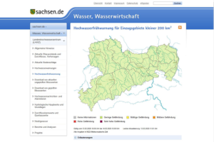
How does it work? (input data, method) | A region-specific map of flood hazard in small catchment areas is produced by the combined assessment of area characteristics, hydrological preconditions, precipitation data and meteorological forecasts. This is an estimation of phenomena that may occur during the forecast period. The flood hazard is subdivided by means of a five-part scale from “low hazard” to “very high hazard” and published for 16 warning areas in Saxony. |
Where to get information and how to interpret them? (communication products/channels, guidance how to interpret the information/graphics etc.) | The information is published via a traffic-light map on the website of the Saxon Flood Centre. The flood threat for the upcoming 24 hours for 16 warning areas is indicated by 5 classes. Through clicking in a warning area, a popup window opens and a graph shows the development of the flash flood threat over the forecast horizon. Additionally, a RSS feed allows users to customise the warning information with help of a Feed-Reader. |
Lead Time | 24 hours |
Update Cycle | 1 hour |
Name | Hungarian Hydrological Forecasting Service (Országos Vízjelző Szolgálat) |
URL |
|
Type | Hydrological Early Warning System |
Operator and spatial scope | OVF General Directorate of Water Management (Országos Vízügyi Főigazgatóság), Hungary |
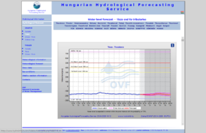
How does it work? (input data, method) | Hungarian Hydrological Forecasting Service produces every morning water level forecasts for Danube, Tisza, Drava rivers and their tributaries. The forecasting is based on predicted and measured precipitation and temperature, snow data, surface runoff model. Forecast accuracy is expressed by objective numbers determined with statistical analysis of previous years’ forecast errors. |
Where to get information and how to interpret them? (communication products/channels, guidance how to interpret the information/graphics etc.) | The forecasts are presented on the website on graphs and in table form. Historical data are also available in table form. Daily Water Regime Map presents hydrological conditions and expected water levels along the main rivers. |
Lead Time | 6 days |
Update Cycle | 24 hours During flood events forecasts are issued more times a day including the most up-to-date measurements and meteorological forecasts. |
Name | ISOK – The IT system of the Country’s Protection Against Extreme Hazards (Informatyczny System Osłony Kraju przed nadzwyczajnymi zagrożeniami: ISOK) |
URL | |
Type | Warning system against meteorological hazards and weather extremes |
Operator and spatial scope | A consortium of Polish institutions, including the Institute of Meteorology and Water Management – National Research Institute (IMGW-PIB) |
How does it work? (input data, method) | ISOK is a comprehensive, advanced tool for analysing and warning against dangerous meteorological and hydrological phenomena (flood and drought). The Map Portal provides among others: hydrological warnings issued by IMGW-PIB, Flood Hazard Maps, Flood Risk Maps. Warnings issued by IMGW-PIB provide important severe hydrological information, according to the criteria for different alert level (moderate, high, very high). |
Where to get information and how to interpret them? (communication products/channels, guidance how to interpret the information/graphics etc.) | ISOK is an important element supporting crisis management in Poland and information platform for institutions responsible for flood protection. |
Lead Time | Next 12, 24, and 48 h |
Update Cycle | 12 hours; during flood events forecasts and warnings are issued more times a day including the update data and meteorological forecasts |
Web applications:
- Official mobile app from the Czech hydrometeorological Institute CHMÚ and CHMÚ+ (including risk of flash floods) – The application is intended for users of mobile devices with the operating system iOS 9 and higher or with
Android 4.4 and higher.
OUR STORIES
Involve your target groups in the development

“Target group-oriented communication and training of the recipients on early warning information is probably the most important task when establishing an early warning system in an area.” (Florian Kerl, Saxon State Office for Environment, Agriculture and Geology, Germany; developer of the Saxon flash flood early warning system)
“In Croatia, the activities of alerting and notifying the population are done by the central state administration body in charge of civil protection duties, which also coordinates the actions of all the bodies included in an integrated alert system in Croatia. In the frame of RAINMAN, comprehensive analysis and mapping of pluvial flood risks and pluvial flood hazards for the City of Zagreb and for the City of Umag has been done. This analysis enabled definition of critical rain thresholds and consequently warning levels proposal. Internal testing of proposed thresholds against ALADIN and ECMWF forecasts is still under way as during the project there were no significant pluvial episodes to validate it. If the system proves to be beneficial, further activities on its administrative setup are foreseen to put it to operational use and available to broader audience as well as to cover other parts of Croatia with it." (Alan Cibilić, Croatian Waters, Croatia)
Development of a mobile warning app in Hungary
Recommendations for the improvement of the warning and alarm tool of the City of Graz
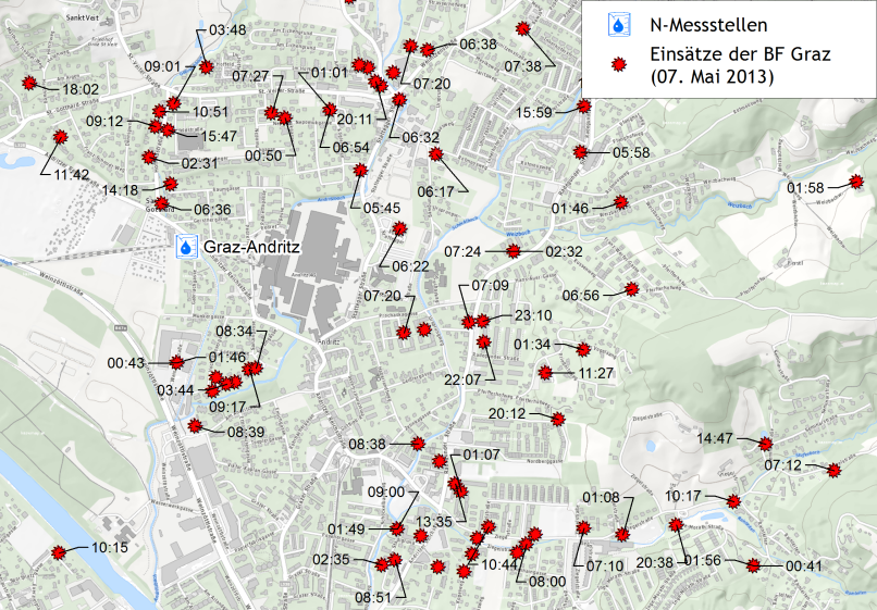
"An automated heavy rain warning can help to use the available time between the first warning and the onset of flooding in the best possible way. The City of Graz uses a traffic light system for triggering predefined operational measures and for informing the population of Graz about the current hazard situation. Recommendations were developed for improving this system by consideration of all available data to receive more precise heavy rain warnings. In addition to the precipitation, other parameters influence the runoff in an area, such as preceding soil moisture, vegetation cover, snow melting, snowfall, degree of sealing." (Cornelia Jöbstl, Office of the Styrian Government, Austria)


